The Vision
The vision is to transform an unloved and overlooked piece of industrial land in Birkenhead into an amazing new green urban village that with the removal of the flyovers will restitch the town together for the first time in 50 years. It will be a unique place to call home, framed in the grid iron plan of Birkenhead and capitalising on heritage and wider views. This will be a place focused on creating high quality contemporary family living, connected to the heart of the town centre, but with a feeling of being distinct and unique afforded by the natural low point in the town and historic boundaries to the railway.
This will be a place that is low carbon at its heart, with streets focused on people and cycles rather than cars. Two train stations, bus routes, and a clear strategy for new sustainable urban drainage and biodiverse rich landscaping will create a place that is truly sustainable and improves the lives of both new and existing residents alike.
The design principles below have been central in preparing the emerging masterplan for the site, so it can offer as many benefits as possible.
Design Principles
There are 14 key design principles that underpin the draft masterplan:
The Birkenhead Grid (The Laird Grid) – The key move within the scheme is to use the historic Birkenhead Laird Grid to form the streets and plots that form the masterplan grid.
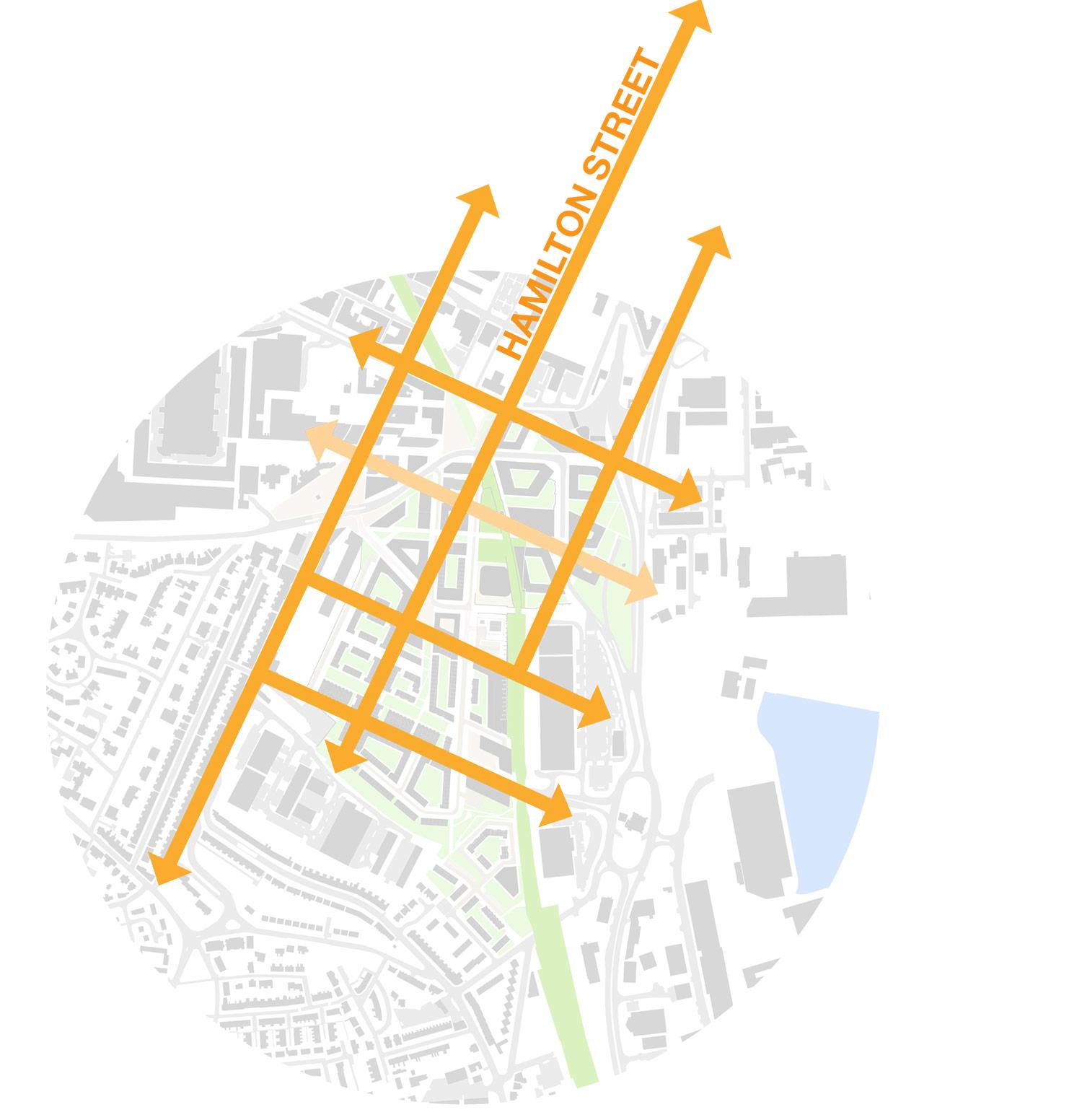
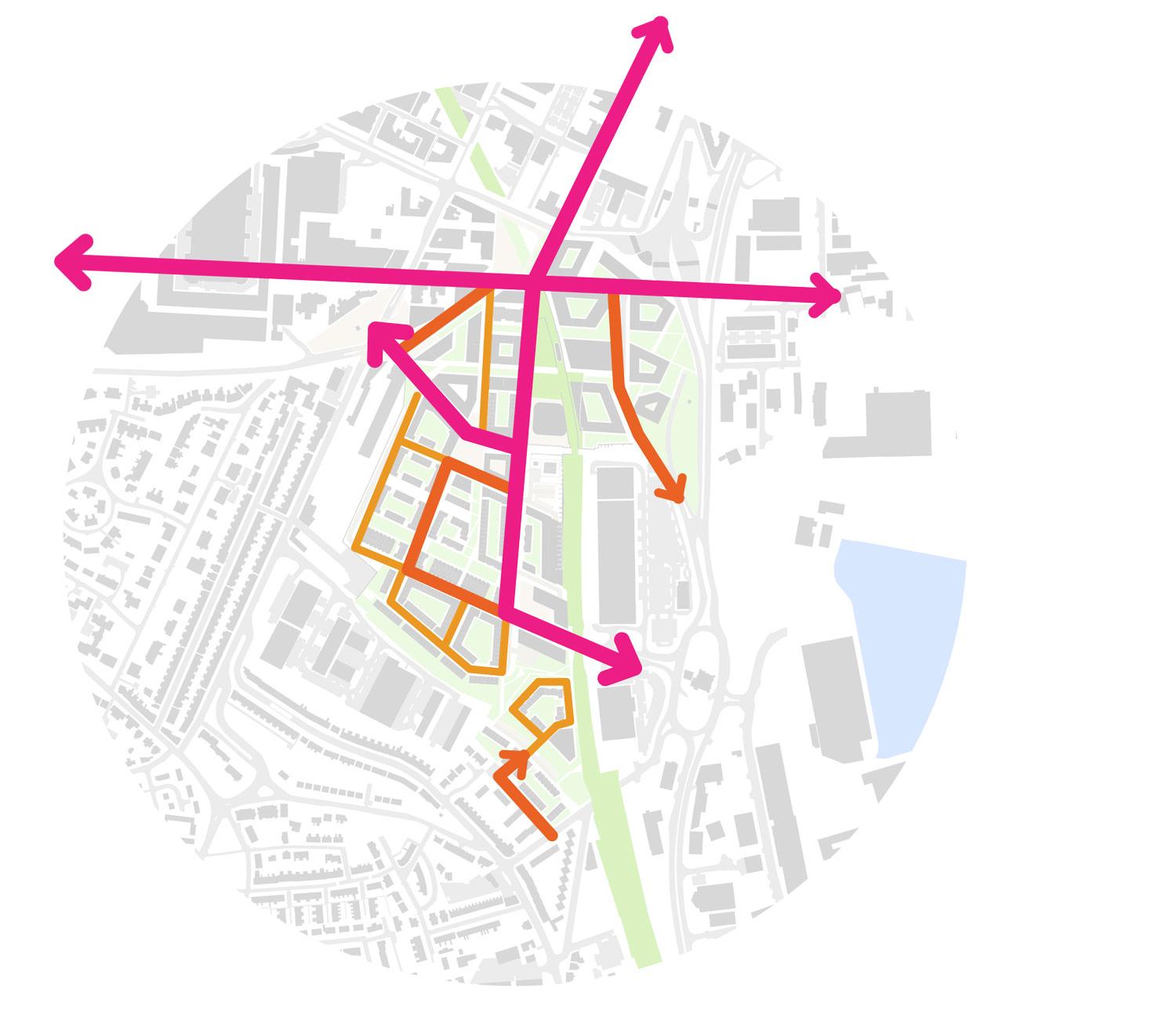
Merging the Historical and the Industrial grids – The masterplan grid seeks to form a harmony between the historic ‘Laird Grid’ and the north / south streets that sit within the site. This is achieved by maintaining Jackson Street, Thomas Street and Dock Branch South (which are all on a north / south orientation) and intersecting them with a continuation of the ‘Laird Grid’ (which is approximately 65 degrees off north).
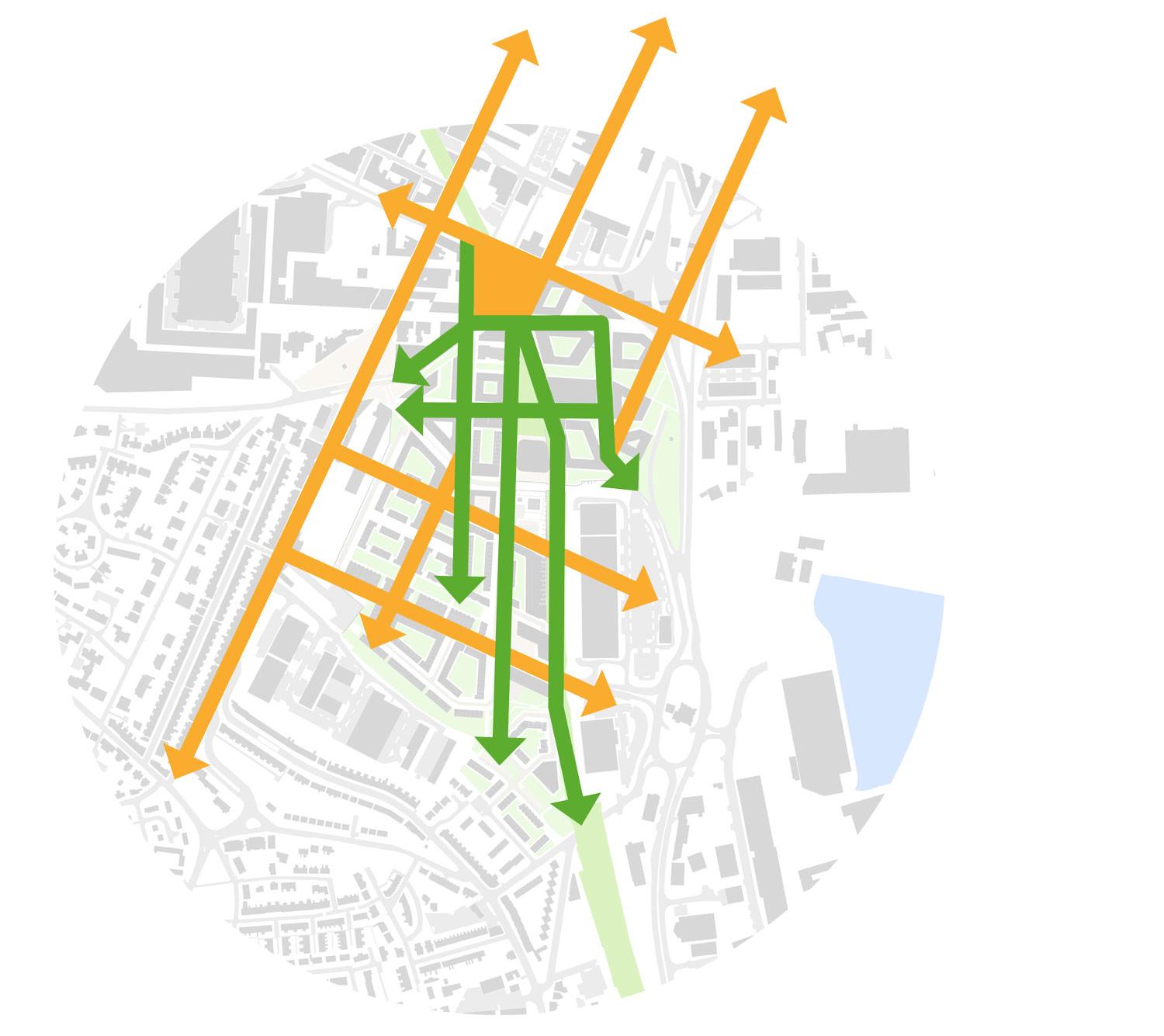
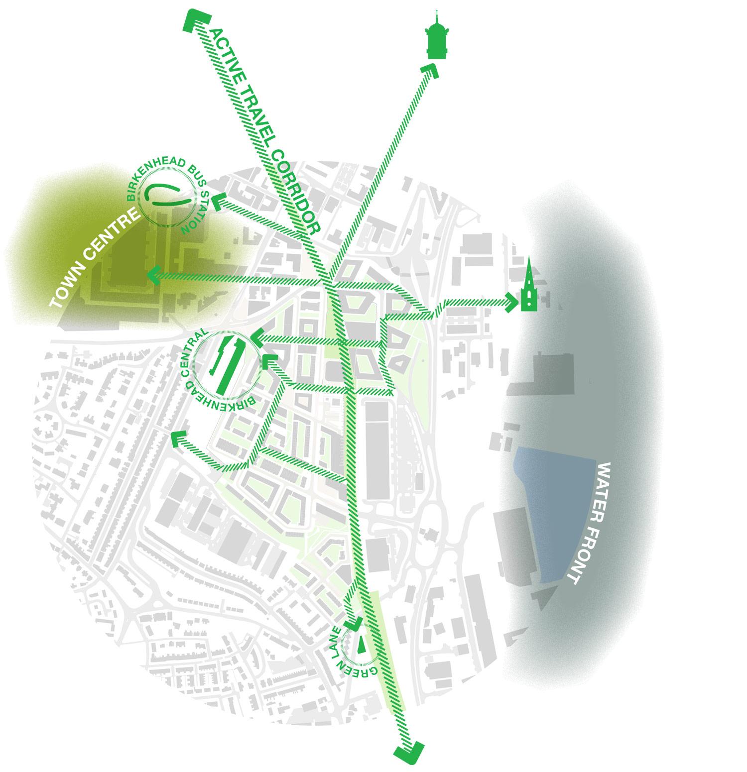
Sustainability at its heart – A New Green Grid – The masterplan opens up the site and provides a new green grid of walkable and cyclable pedestrian streets and parkland. This green grid connects both train stations together, along with reconnecting the town centre to the waterfront.
Creating a clear character hierarchy of streets and places – Through the creation of a clear hierarchy of streets and places the masterplan will develop a series of experiences for each street and square that will create their identity. The distinctiveness of each street will be formed by this clear hierarchy.
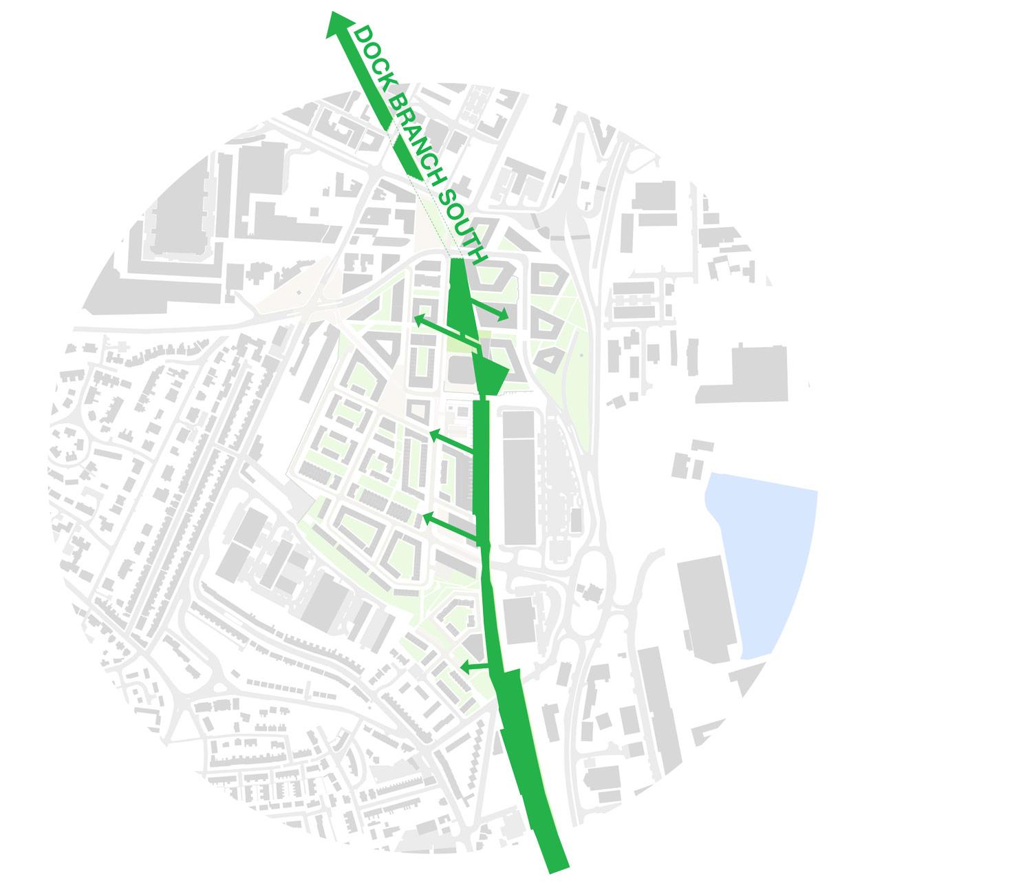
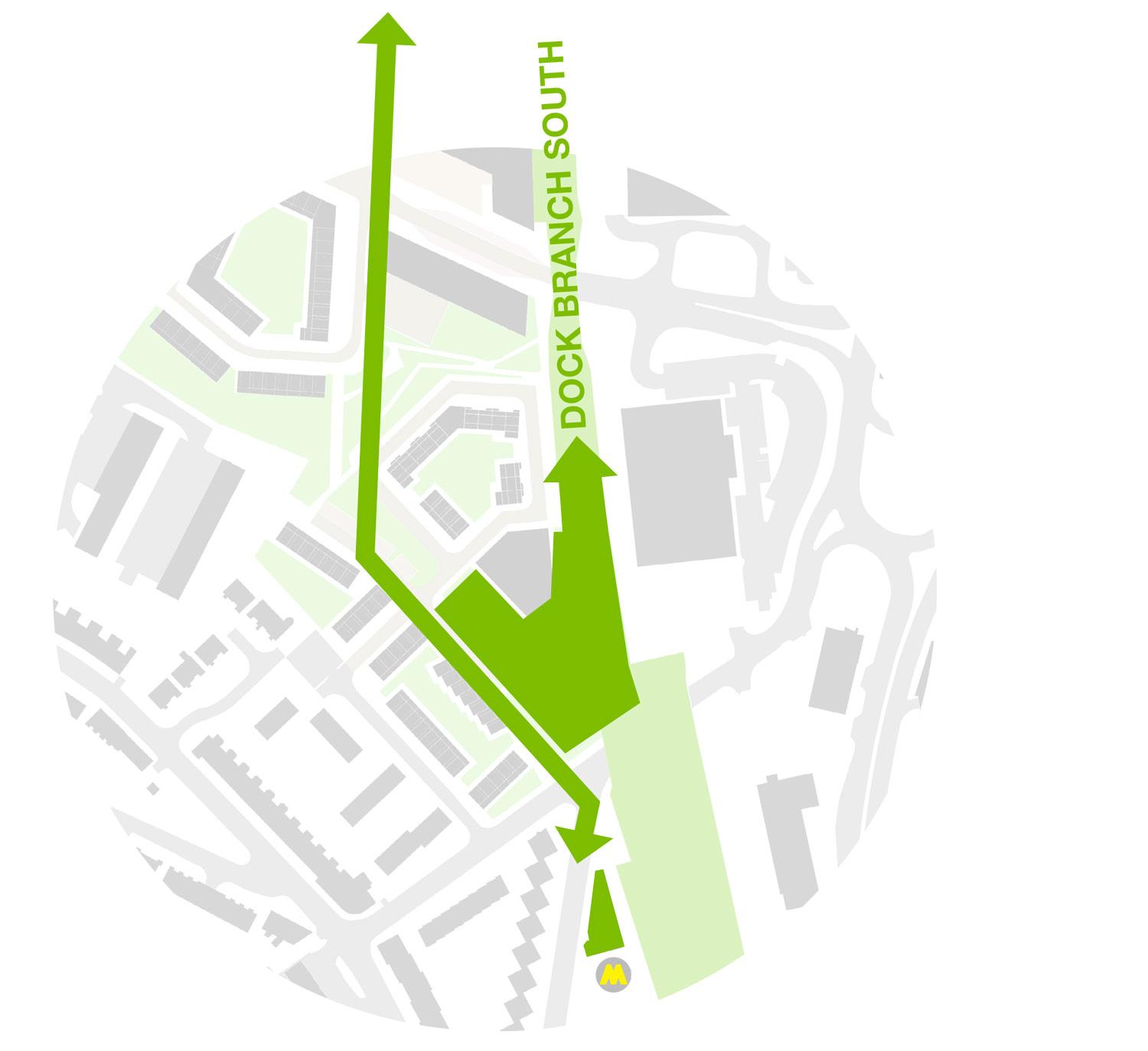
Connecting into Dock Branch South – The transformation of the disused high level railway into a walkable park provides the masterplan with a green spine. Which creates the perfect opportunity for both high level and low level connections into the park, and a North/South route through the scheme. Along with a linear park to serve the new residents and local community.
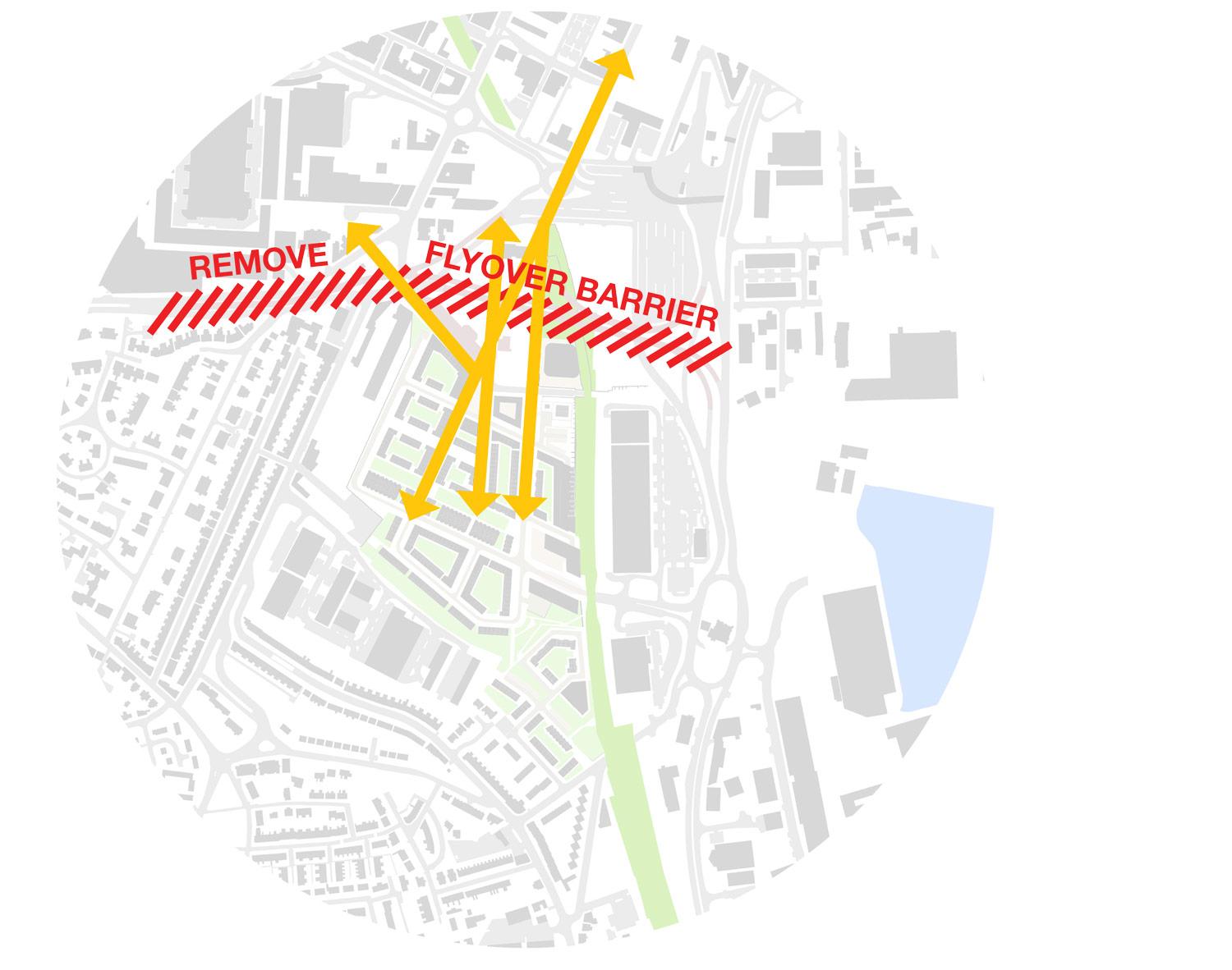
Restitching North & South back together – In order to stitch the North and South of the site back together the barrier that is created by the flyovers needs to be removed. This key move will transform the area and provide the North/ South permeability through the site, that is missing today.
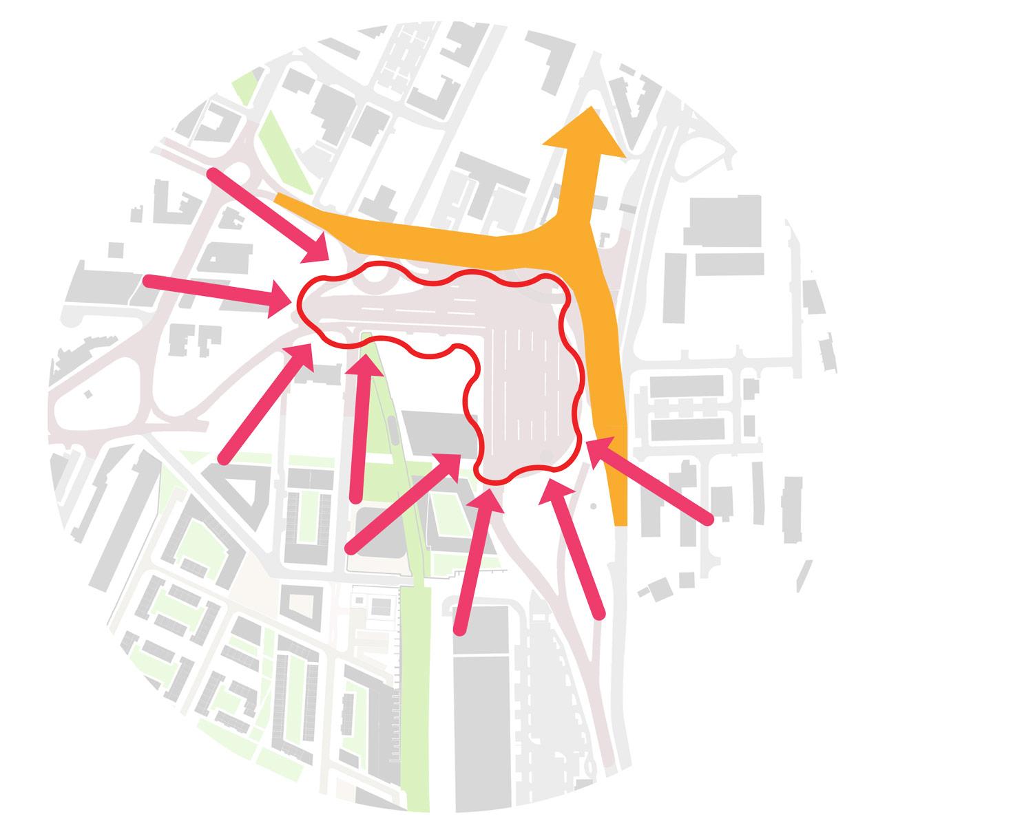
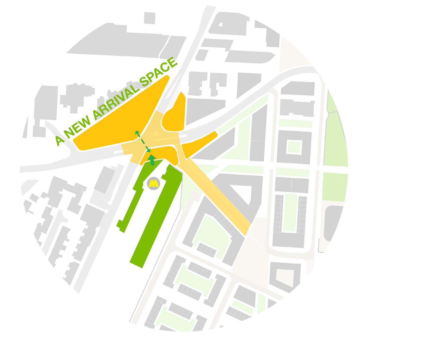
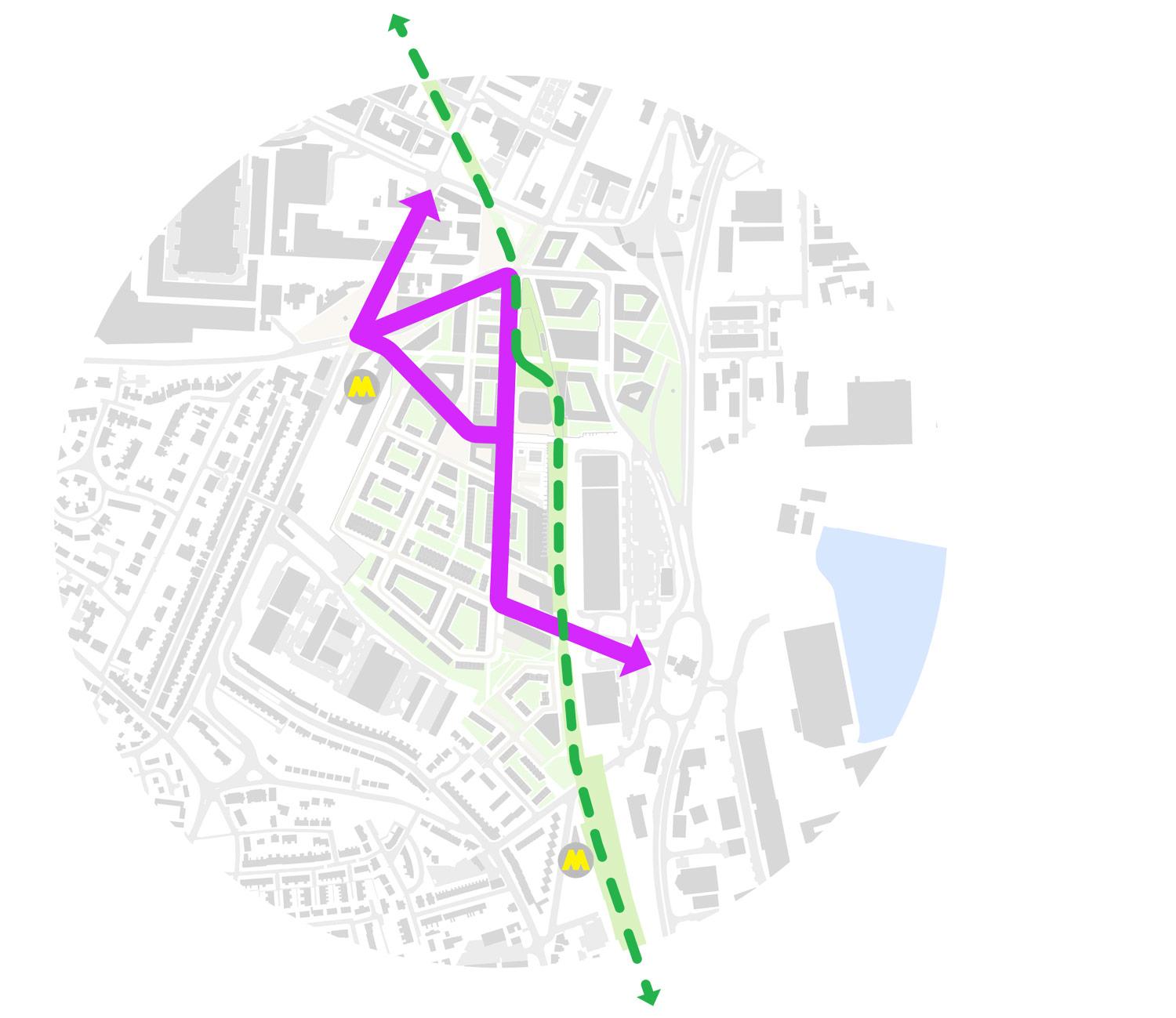
Connecting into the Town Centre with the opportunity for a new context to Central Station – Birkenhead Central station has limited entrance space outside of the station. A key driver for the masterplan is to create a new public space that serves the station and acts as a gateway both into the site from West Birkenhead and into Birkenhead from people using Central Station. This is given greater public importance by the introduction of a new primary school that sits directly onto the square and serves the local community.
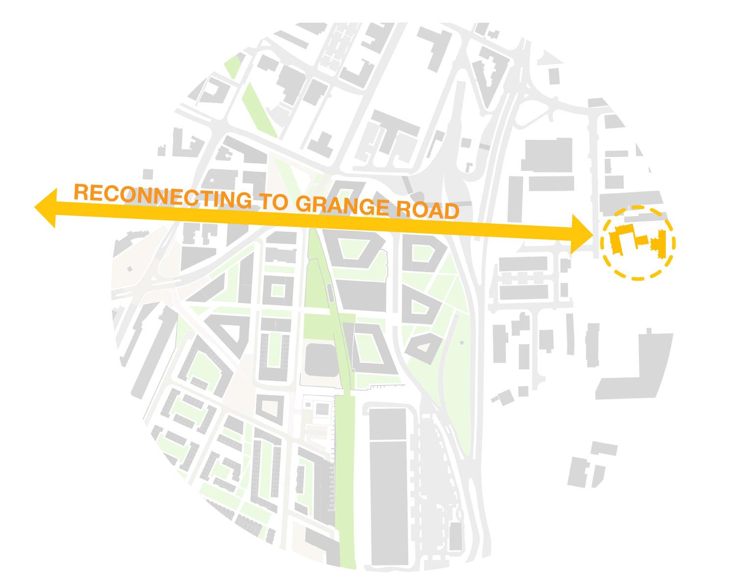
Reforming connections to the Priory – Historically Grange Road connected the town centre with the Priory. One of our key aims is to reconnect Grange Road with the Priory by creating a new pedestrian road from the town centre to the edge of Chester Road. This provides future opportunity to create a new footbridge or a super crossing down to the docks.
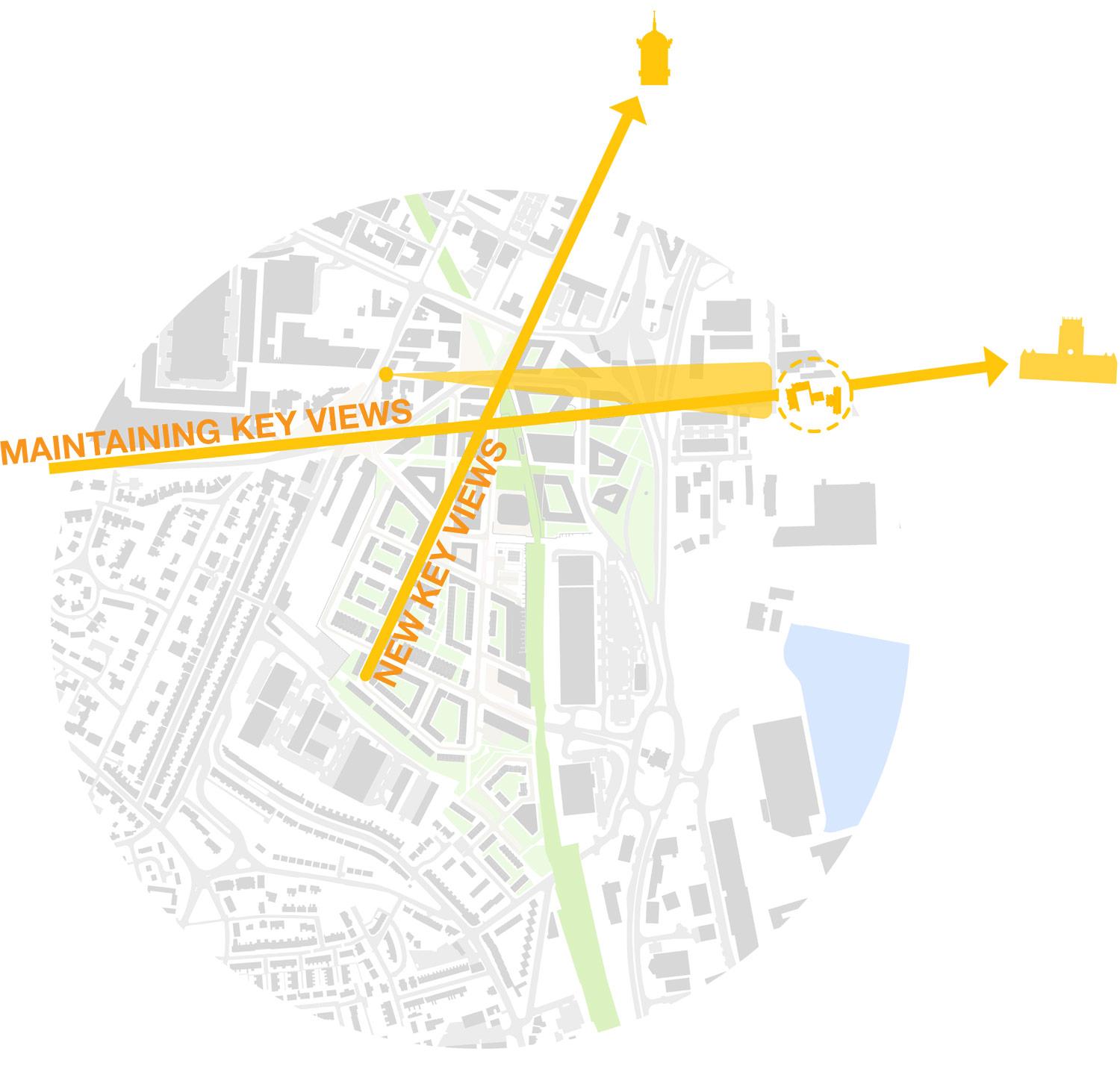
Capitalising on key views and vista – Through opening up streets, carefully sculpting buildings and reintroducing historic street patterns the masterplan will both protect existing view corridors, but will also provide new ones.
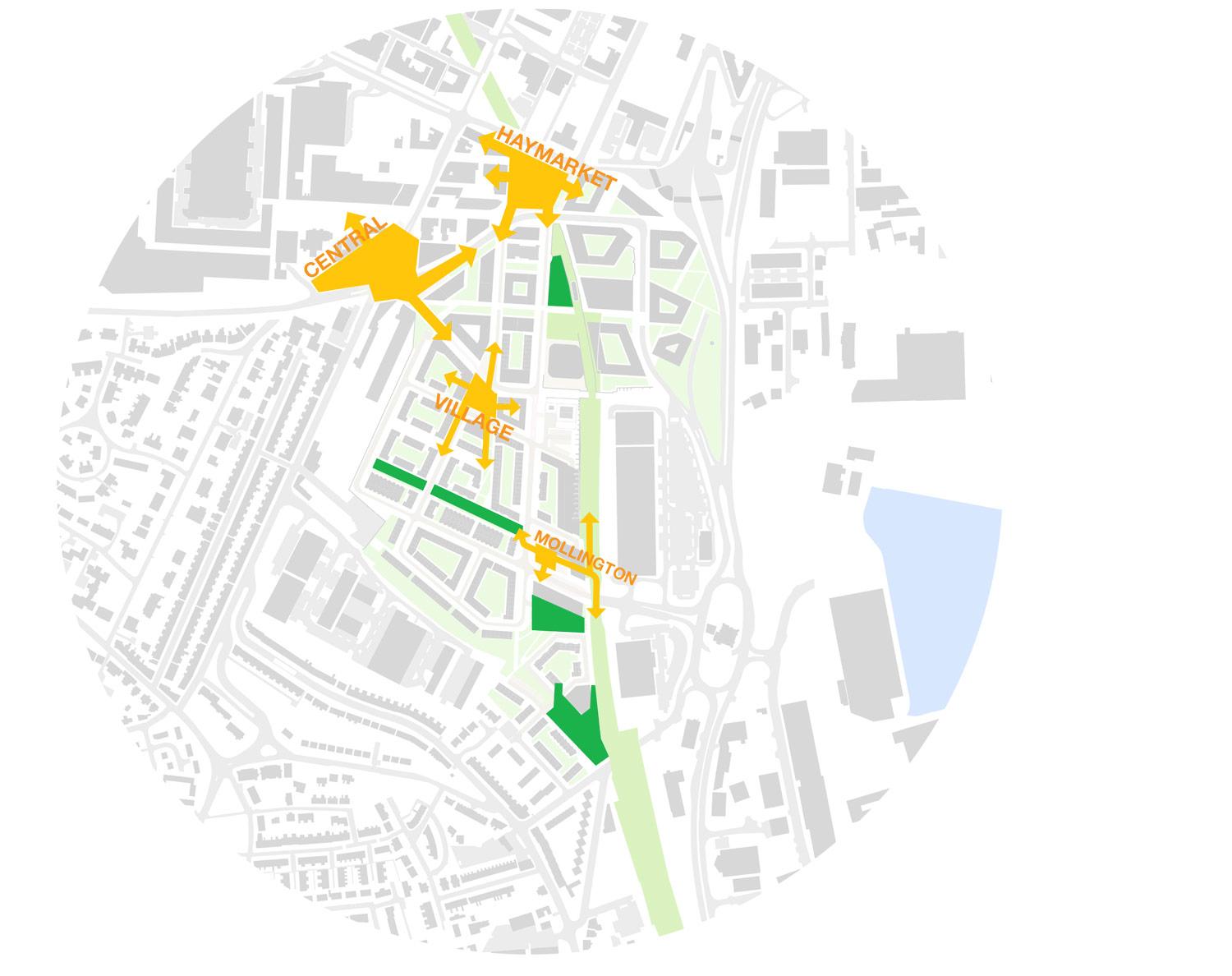
Creating new public spaces with clear identity and purpose – The creation of new key public spaces that form the gateways into the masterplan is a key driver for the scheme. Central, Haymarket and Mollington Square provide the key nodal points that form the main entrances into the site. The Village Square forms the heart of the site and the centre of the new Urban Village.
Connecting through to Green Lane with the opportunity for a new public park – Connecting the development with Green Lane station is key to the success of the sustainable transport aims of the scheme. A new public park has been created at the entrance to the site from Green Lane, which connects directly into Dock Branch South.
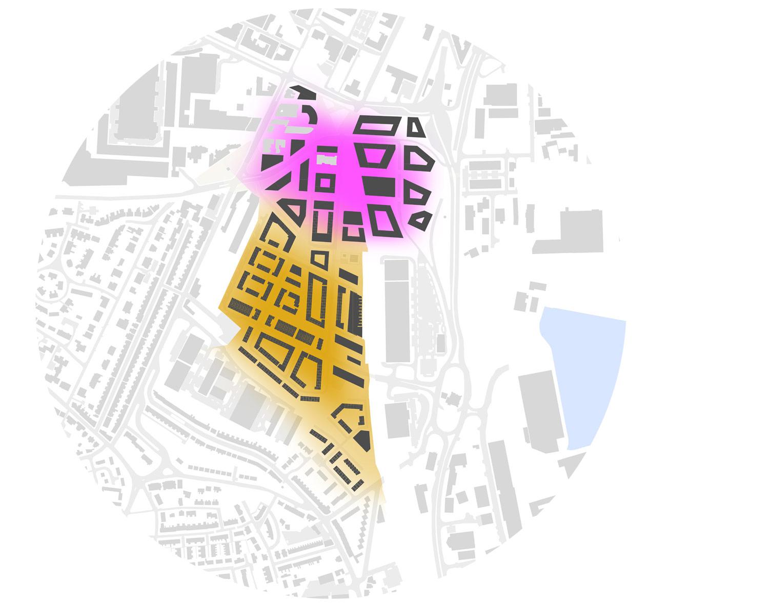
Creating distinct character areas – There are multiple zones and character spaces within the masterplan. However there are two key distinct character areas. The south of Hind Street is focused around an Urban Village made up of primarily family living residential accommodation. The north of Hind Street is focused around mixed use commercial and high density town centre living.
Designing for Green & Active Travel – Sustainable travel and public transport is a major consideration. The site is perfectly placed between Birkenhead Central and Green Lane Station. This allows the masterplan to respond by creating walk-able and cycling routes to both stations. An active travel corridor is provided via Dock Branch South and the scheme has been developed to allow for a mass transit or regular bus routes, connecting West & East with a North / South route through the centre of the site.
Redesigning the Queensway Tunnel Plaza – The consolidation of the Queensway tunnel plaza is a key design driver for the redevelopment and opening up of the plots to the North East of the scheme. The reduction in space outside of the tunnel mouth provides the opportunity to reclaim new plots of land, along with simplifying the entrance and exit to the tunnel.